Drone services in Vilnius
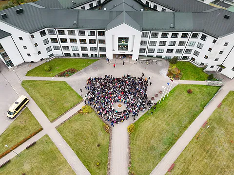
We take drone photos and video in and around Vilnius: houses, land plots, construction sites, events and the city from the air. On plot photos we mark the boundaries and easements. We also fly in restricted zones, once we have the permits. Prices from €60.


What you get and how we work.
- Photos from several heights: the site up close and everything around it
- The plot boundary and easements right on the photo
- Aerial video: flights around and over the site
- Photos by email the same day
- Legal flights: TKA registration, A1/A3 qualification, UTM permits
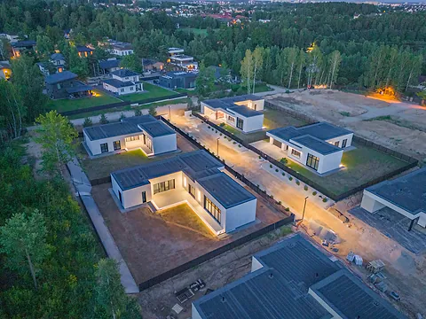
Drone photography shows what you can't see from the ground: where a plot ends, what the roof looks like or how far away the forest is. From the air it's clear in a second.
We fly in whatever weather you want: a sunny day, an overcast one, evening light or winter. If you're not sure, we'll tell you when the place will look its best.
Drone photography for real estate listings
Most people look at listings on their phone, scrolling fast. An aerial shot among the usual photos catches the eye, and a short flight around the house shows the surroundings better than photos from the yard. A listing like that also looks more serious: you can tell the seller took care of it.
What people order drone photography for
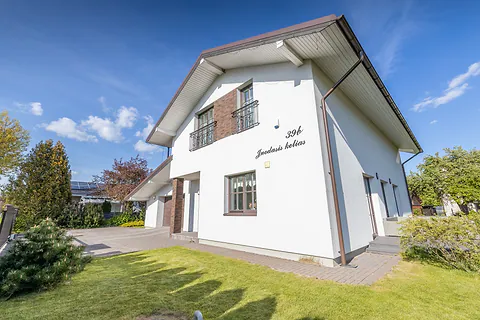
Aerial photos are most often needed when selling a house or land, or presenting a new project, a commercial building or an outdoor event. We also photograph the city and nature for advertising and websites.
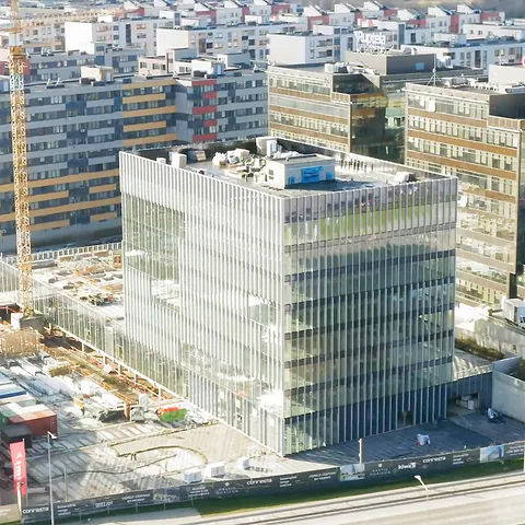
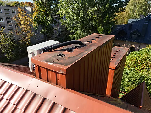
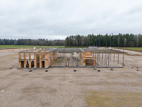
Some jobs have their own pages: drone building inspection for roofs and facades, construction progress for developers and contractors.
Land plots with marked boundaries
A photo of a plot without the boundary usually shows just a field. The buyer doesn't know where the land starts and ends, so they call to ask or skip the listing.
So we find the plot by its address or cadastral number, photograph it from the air and draw the boundary on the photo. If there are easements, such as a road or utility lines, we mark them separately.
A shot straight from above shows the shape of the plot and the neighbors. An angled shot shows the terrain and how the plot looks from the road.
Homesteads and forest plots
You can't show a large plot with a homestead or forest from the ground. From the air you can see the buildings, the tracks, the pond and the edge of the forest, and the marked boundary leaves no doubt about how much land is for sale.
If there is a house on the plot, we can photograph it up close too. More on the real estate photography page.
From what height
We choose the height based on what needs to be shown. Up close you see the facade and the terrace, higher up the whole plot and the neighbors, and higher still the whole area.
From high up we show what is around: the forest, the water, the roads and the city. For a buyer this often matters more than the house itself.
Rules and permits
We fly under EU and Lithuanian rules: we are registered with Lithuania's Transport Competence Agency (TKA) and hold the A1/A3 pilot qualification. A large part of Vilnius falls within the airport zone and other restricted zones, so we coordinate our flights through the UTM system.
We handle the flight permits ourselves.
Drone video
Besides photos, we also film short flights: around the site, over it or toward it from a distance. They work for a listing, a website and social media.
For longer edited videos, see the promo videos page.
What clients say
“I've tried a lot of photographers and drone photo and video services. This photo and video team is the best! They really know their job.”


Films
- TV tower renovation · Nordvia 1:07. Workers on a platform of the Vilnius TV tower, filmed by drone.
- Riverbank works 0:21. Machinery working on a riverbank, filmed by drone.
- Plot for sale with boundaries 0:31. Plot from the air with marked boundaries and captions.
Projects like this
All work


Frequently asked.
Can you fly near the airport?
Yes. In restricted zones we fly once we have a permit, so it's worth telling us about a location like that a few days earlier.
What weather do you fly in?
Whatever you want: a sunny day, an overcast one, evening or winter. If the weather that day isn't what you wanted, we'll move the flight to a day that suits you.
Can I order only aerial photos?
Yes, without any other services.
Do I need to come along?
You can come along and show us what matters, if you like. If not, we do everything ourselves: just send us the address or the cadastral number.
Do you fly outside Vilnius?
Yes. We mostly fly in and around Vilnius, but we also work elsewhere in Lithuania. We tell you the travel costs in advance.
How much does drone photography cost?
From €60. The final price depends on the size of the site or plot, how far away it is, whether you need photos, video or both, and whether the location is in a restricted zone. Call us or fill in the form, and we'll tell you the exact price in less than an hour.
What would it cost? We reply within an hour.
Choose what you need and leave your phone number. We will call, go over the details and tell you the price.